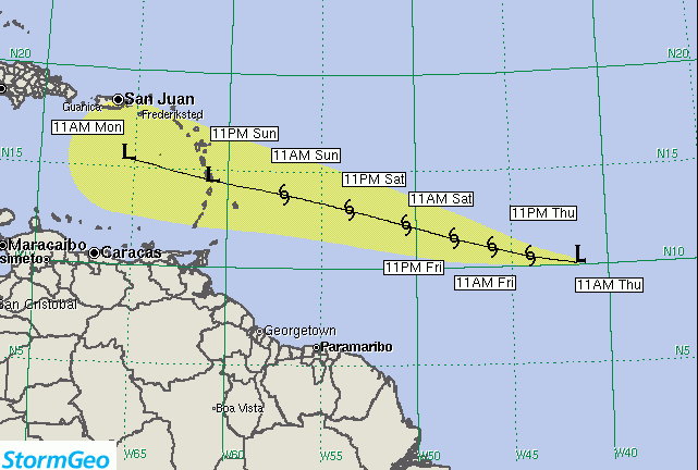
5TH July 2018 – The current forecast shows the center of Tropical Depression Two located near latitude 10.2 North, longitude 41.4 West. The depression is moving toward the west near 16 mph (26 km/h). A fast westward to west-northwestward motion is expected through the weekend.
Maximum sustained winds are near 35 mph (55 km/h) with higher gusts. Some strengthening is possible, and the depression could become a tropical storm later today or on Friday.
The forecast track is a little to the south of the model guidance. This is because the depression has been consistently moving south of the model forecasts. As the system approaches the Leeward Islands, it should accelerate significantly. The forecast brings the system through the Lesser Antilles late Sunday.
Residents are being asked to follow the official information being issued by the Department of Disaster Management. We are aware of the information that has been circulated exaggerating the current status of the system; this has caused much anxiety among members of the public. Persons wishing to verify information can contact The Department of Disaster Management or monitor the system via website at www.bviddm.com or subscribe for updates.
Disclaimer: The Department of Disaster Management (DDM) is not an official Meteorological Office. The Information disseminated by the Department is gathered from a number of professional sources used or contracted by the DDM to provide such information. This information is to be used as a guide by anyone who has interest in local weather conditions. By no means can the DDM or the BVI Government be held accountable by anyone who uses this information appropriately for legal evidence or in justification of any decision which may result in the loss of finances, property or life.


