
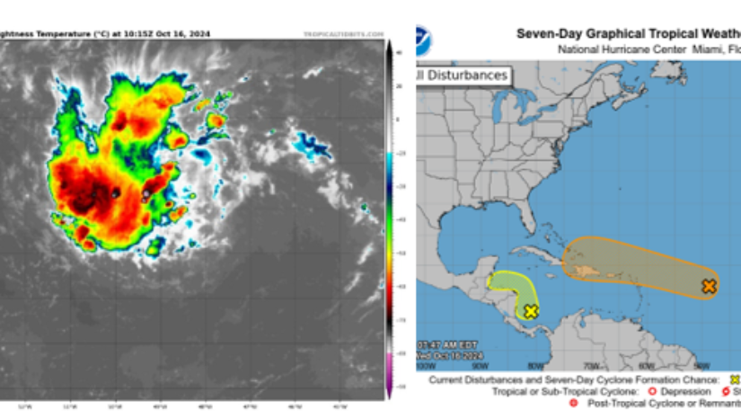
Invest 94L is progressing across the Atlantic as an area of disturbed weather with the potential of becoming a tropical cyclone near the Virgin Islands. Invest 94 is located at approximately 16N 46W, which is about 1,260 miles southeast of the Territory. Its current movement is westward approximately 12 mph with sustained winds of 28 mph.
Invest 94L is projected to move westward to west -northwestward over the next few days. On this path it is expected to pass very closely north of Anegada. Invest 94L is could strengthen to a tropical depression by Friday going into Saturday.
The Territory will experience a heightened chance of thunderstorms as Invest 94L passes in the vicinity. Marine conditions could get hazardous with wave heights up to 8ft and northeasterly swells up to 4ft this weekend. These conditions could increase the risk of coastal and urban flooding throughout the Territory.
Residents should be mindful that it does not take tropical cyclone to have severe impacts. As result, the Department of
Disaster Management encourages residents to remain vigilant and pay keen attention to updates.
Disclaimer: The Department of Disaster Management (DDM) is not a Meteorological Office. Information shared by the Department is gathered from a number of professional sources contracted by the Department. This information should be used as a guide for anyone who has an interest in local weather conditions. By no means can DDM or the Government of the Virgin Islands be held accountable by anyone who uses this information appropriately for legal evidence or in justification of any decision, which may result in the loss of finances, property or life.


